Welcome to The Next Line #53! The weekly newsletter where we share useful travel info on hiking, climbing and skiing in world class destinations, and other interesting stuff. New here? Subscribe in one click with this magic link.
I asked you what you wanted this newsletter to be about in The Next Line #52, and you voted for Manaslu. 🙌🏼
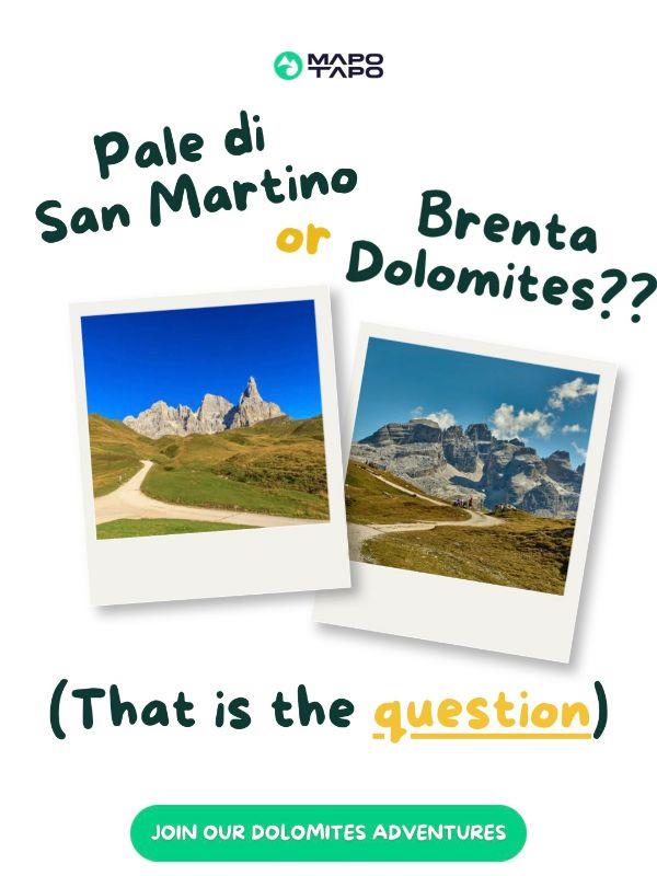
Now vote for the next topic below. 👇🏼👀 |
|
|
| | |
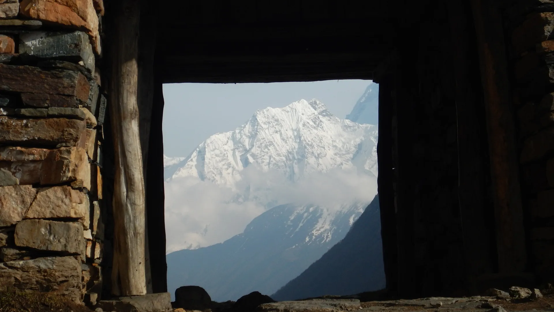
| 🏔️ Manaslu — “Mountain of the Spirit” | If you’re always chasing #thenextline—off the beaten path and far from the crowds—the Manaslu region is where adventure still feels raw. | Manaslu, the eighth-highest mountain in the world (8,163 m). Its name comes from the Sanskrit manasa, meaning “spirit” — and that’s exactly what this remote corner of north-central Nepal embodies. | | Located between the Annapurna range and Tibet, the Manaslu region is where Himalayan culture meets pure wilderness. Tibetan heritage runs deep here — especially in the upper valleys — and ancient trade routes between Nepal and Tibet still pulse with life across the Larkya La Pass. | Unlike the Everest or Annapurna regions, Manaslu remains remote and less visited. Few people trek or climb here, but that’s exactly what makes it special. Things are slowly changing, though — and the secret’s getting out. Learn more about the region below 👇🏼 | | #1 Iconic Ascents (…and Descents) | A short recap of Manaslu’s iconic ascents…and descents. 👇🏼 | | | Accomplishement | Year | Mountaineers |
|---|
First Ascent | 1956 | Toshio Imanishi (Japan) and Gyalzen Norbu Sherpa (Nepal) | First Women's Ascent | 1971 | Kyoko Sato (Japan) | First Winter Ascent | 1984 | Maciej Berbeka and Ryszard Gajewski (Poland) | First Complete Ski Descent | 2011 | Adrian Ballinger (USA) Sergey Baranov (Russia) | First Women’s Complete Ski Descent | 2021 | Anna Tybor (Poland) | Fastest Ascent (9h24m) | 2024 | Ty Andrews |
|
| | |
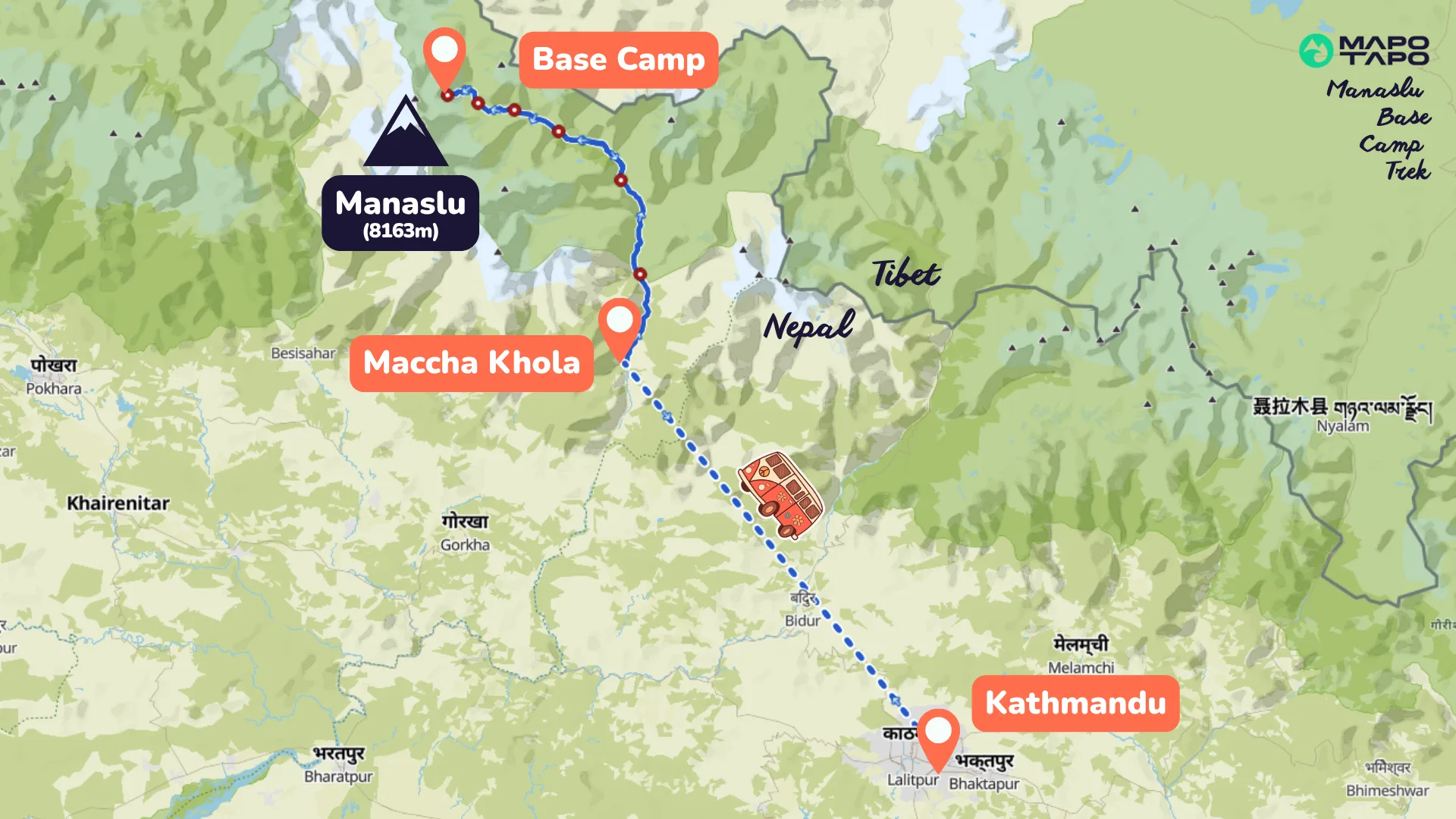
| | #3 Main Treks and Climbs | The Manaslu region is a true off-the-beaten-path destination — especially in its remote corners like the Tsum Valley along the Tibet–Nepal border. However, paths are becoming busier as the region is gaining popularity. | Today, it offers some of Nepal’s most iconic treks and accessible trekking peaks, yet much of it remains wild and unexplored. Come before the crowds do. 👀👀 | | | #4 How to get there | To reach Manaslu Base Camp, fly into Kathmandu International Airport, then take a 7-hour bus or jeep to Machha Khola (or Soti Khola, the classic Manaslu Circuit starting point). From there, trek north along the Budhi Gandaki River through Jagat, Namrung, Lho, and Samagaon, before ascending to Manaslu Base Camp (4,800 m) beneath the mountain’s north face. | Adventurers can then cross the Larkya La Pass (5,106 m) to complete the Manaslu Circuit, or detour into the Tsum Valley for an extra dose of culture and monasteries. | | | | | What topic should we cover on #thenextline54?Vote for the topic I should cover in the next edition of the Mapo Tapo Newsletter | |
|
| | 🏔️ Surfing the web | Some of our favorite content we found on the internet this week… | Kilian Jornet: States of Elevation. The GOAT of ultra-running (is it only running?) completed his hardest project so far: linking all 72 accessible 14,000-foot peaks in the USA by foot and bike (3,197 miles, 403,690 feet of climbing). See more on Kilian’s Instagram. Nikolai Schrimer's new video: Chacha Land. Nikolai Schirmer, Lucas Wachs and Sam Favret set off to abandoned towns in the Caucasus ranges of Georgia. First, they ski Japan-like pow conditions in Bakhmaro, and then they move to big-mountain terrain in Mestia. Skialper’s Buyers Guide 2026. This Italian magazine publishes this backcountry ski gear review yearly. It is probably one of the best out there. Paper and online versions available for purchase here.
| | 👀 Job board | A job alert for outdoor lovers—because your dream company might just be hiring: | | | ❤ Oh no, this newsletter just ended | What now? | | | |
|